Take the path less traveled to Poo Poo Point for a different perspective on an old favorite! Did you know there are two trails to Poo Poo Point? The Chirico Trail and the Poo Poo Trail. While the Chirico is the more well-known one, the Poo Poo Trail takes you to the same paraglider launchpad that the Chirico Trail does, but via a longer and more meandery route, and one with far less people.
Where Does The Poo Poo Trail Begin?
There are two ways to get to this entrance of the Poo Poo Trail: the small parking lot near the intersection of 2nd Avenue and Front Street, or the trail behind the high school near the tennis courts.
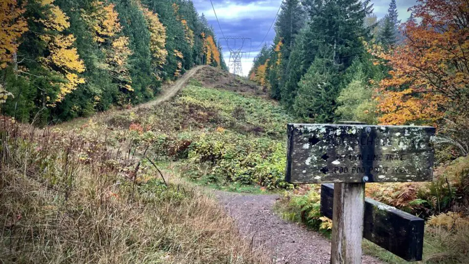
If you start from the parking lot, the trail is obvious yet unsigned, and you’ll walk just a few minutes before seeing the High School Trail sign, where you’ll go right then quickly right again, climbing a gentle arc going left. You’ll stay on that trail for a half mile or so, passing a rusted old gate, the turnoff for the Adventure Trail, and a small pond. When you reach the clearing under the power lines you’ll see the signpost for a few trails; hang a right.
If you start from behind the high school at the end of SE Evans Street, you’ll head south on the trail which is cleverly marked “trail,” and go past all the tennis courts until you reach the High School Trail sign on your left. Go left, then right, then up that arc mentioned above, and you’ll hit the Poo Poo Trail in about a half mile.
From that signpost intersection, you’ll climb at a gentle yet steady incline for a couple miles, crossing a couple tiny bridges over tiny streams as you traverse Many Creeks Valley, then one big bridge at Gap Creek well past the halfway point. The bridge makes a nice spot for a break if you’re the break type, and keep your eyes out for wildlife near the waterfall (I’ve seen otter here!). The incline picks up a little bit after the bridge for a few switchbacks to the new turnoff (which is signed, and veers right) but then flattens out again. This new section is soft and mulchy and easy on the feet, and delivers you to the top after about a half mile.
How Long Of A Hike Is Poo Poo Point?
Going this way, it’s about 7.6 miles round trip, though with the trail construction/rerouting that was completed during the summer of 2021, it might be a hair shorter. This rerouting shaved a couple hundred feet from the elevation gain as well, bringing the trail across two small ravines rather than up and down each (I still have mixed feelings about this. My knees like it, but I do miss the ruggedness of the old route).
If you know your usual pace, this hike should take about the same time as your typical 7-8 miler, though with only 1760 feet of gain, there are a lot of flatter runnable sections, so it’s usually quicker than say Mount Si or Granite Mountain, which are of a similar distance but with more gain. For the slower hiker or those with kids or pets in tow, allow 3ish hours up and 2ish down. Typically 4 hours should be plenty for an average person’s round trip. When I really give it some gas it’s less than 2 hours round trip. Just depends on if you want a stroll or a run; the Poo Poo Trail delivers either option nicely.
Can You Hike To Poo Poo Point In The Snow?
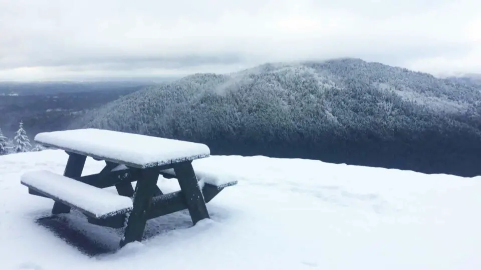
Absolutely! I find this route to be more pleasurable in snow than the Chirico Trail, especially if we’ve just had a big dump and snowshoes are in order. The Chirico is rockier, can be icy or slippery in parts, and the stair-like portions are awkward in snowshoes, but the Poo Poo Trail is flatter, wider, and better for snowshoeing. It’s a great alternative to other local hikes when avalanche danger is high as this trail is pretty much avalanche-proof all winter due to its very gentle slopes.
Is Poo Poo Point A Good Sunset Hike?
Yes, Poo Poo Point is a great sunset hike. With its westerly views and wide open places to sit, Poo Poo’s north launchpad is a great place to watch the sun set. Lake Sammamish and the town of Issaquah are directly below, and on a clear day you can see the skyscrapers of both Bellevue and Seattle in the distance. The trees behind you prevent a full 360º view but the cliff in front of you makes it all feel very expansive nonetheless. Either way you come up, whether via this trail or the Chirico Trail, bring a headlamp or flashlight as night falls quickly in the forest once the sun sinks below the Olympic Range.
Which Route Is Best: Chirico Or Poo Poo?
That depends entirely on your goals and what you want from this hike, because the destination is the same, the view from the top is the same. Neither require any special permit or parking pass, and both are only about a half hour from Seattle.
Poo Poo Trail: longer, flatter, less populated, has rivers and bridges and a nice waterfall. 7.6 miles round trip, 1760 feet of gain. Better for solitude, running, scenery. Yes to restrooms and water sources (always filter).
Chirico Trail: shorter, steeper, quite crowded. 3.8 miles round trip, 1760 feet of gain. Better for training laps, getting quick vert after work, feels safer to those who don’t want to be alone on a trail. Yes to restrooms, no to a water source (bring your own).
Getting There
For either trailhead, take I-90 to exit 17 and head south on Front Street.
For the northern trailhead, turn left at the light at Sunset Way then right on 2nd Ave SE. In about 0.3 miles, turn left on SE Evans Street near the schools. Follow SE Evans Street as it eventually bends sharply to the right and, beyond the Sportsmen’s Club, dead ends at the trailhead. There is room for about six cars to park at the trailhead, and room for many more along the wide shoulders of the approaching street. There are no facilities here.
For the southern trailhead, continue south on Front Street and make a left at the light onto 2nd Avenue SE. On your immediate right is a small graveled parking area with room for six to eight cars. There is also street parking which is hard to come by during school hours. There are no facilities here either.
Wendy Harrington is a California native who has lived in a small town at the foothills of the Cascade Mountains in Washington state since 2001. Her love of trail running and peakbagging has led her to summit all five Washington volcanoes, climb to the high points of three states, and put nearly a thousand miles a year on her boots. Her loves include ridgelines, saddles, granite, one-day pushes on big mountains, anything volcanic, long solo days, and objectives that push limits and test endurance.