Its tagline should be: Great if you have bad knees, terrible if you have a short attention span.
There are two ways up this beast of a mountain: the rugged, brutal, masochistic Old Trail or the gently graded, slowly switchbacking, lush and lovely New Trail. You know those siblings that look a lot alike but one’s the ugly one and one’s the pretty one? That’s this.
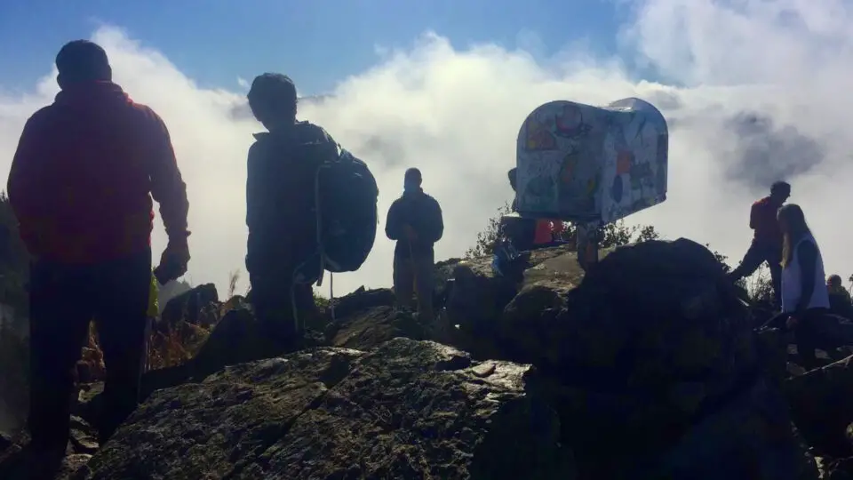
They both gain the same 4000ish feet, but the New Trail takes 4.7 miles to politely ascend what the Old Trail barrels up in 2.3. They both come out of the treeline at the base of the infamous boulder field and converge for the final push: 960 feet of elevation gain in just a half mile, climbing quickly into the sky and topping out at an actual mailbox planted right into the top of the peak like the flag on the moon.
New Trail Description
In a nutshell: Four miles of forest, a half mile of steep mixed terrain.
You start out walking from either parking area and going around the gate and along an old road for just a few minutes. On your left is a nice new-looking trailhead sign with a map and information about the trail, LNT reminders, etc. This is a good place to “pull over” as the trailhead widens to form a little foyer of sorts before ducking into the woods. Airplane your phone, as you won’t have service till the top, get a little snack or water in, take a photo of the map, maybe de-layer, and you’re off for four somewhat monotonous yet peaceful miles.
Confession: I’ve only hiked the New Trail a total of two times. Up once, round trip once, and down once. After getting used to the Old Trail, the New is just mind-bogglingly never-ending and quite frankly a bit boring. My first time, I took the New Trail up because I didn’t trust my own ability or stamina or just overall fitness and agility to take the Old. I was more than ready for it, but my confidence is often the kind where I’m saying how I can’t do something as I’m doing it — then I got to talking with someone at the summit who said that if I was ok with the part above treeline, I could do Old Trail easily, so I decided to trust their opinion and take Old down, and it was love at first hike. I became a loyal OT girl, making the exception to take the boyfriend up and down New for sunset (per his request), and running down it with the kid after summiting via the Old.
Incidentally, that’s a very common way to do it, for people who have bad knees, bad balance, or just don’t like going down steep hills: up Old and down New. They get the cardio and quad benefits of the Old Trail with a comparatively low-impact descent for a 7 mile loop.
From the start, the trail is shaded and manicured, wide and level and tidy like a sidewalk, and so so green. You’ll cross a bridge early on but there aren’t many more landmarks until you meet up with the Old Trail. And when you do, get ready. Though only a half mile, this section takes most regulars 20-30 minutes, and I’ve seen newer hikers take an hour for just that part alone. However. There’s no way around it. The two trails intersect just over a half mile from the summit, in that transitory area between treeline and talus. This part of the trail offers your first views west across Snoqualmie Valley to the neighboring peaks and south to Mount Rainier. Up until then, you’ve been in a forest so thick you can’t tell how high up you actually are, and have been seeing just brown and green if it’s summer or white if it’s winter, but now, from a couple lazy switchbacks along its west upper flank, you see blue sky and more shades of green, or gold and red in the fall, and if you’re an early bird, the oranges and pinks of sunrise.
And then, emerging as if from a doorway, or better yet, walking from the wardrobe into Narnia, at about 3,860 feet, you come face to face with a sprawling, steep, vast boulder field. It is, as the kids say, “extra.” It tumbles out, and up, and looks impossible until you see a faint dusting of tan over the gray rocks and realize there’s a trail of sorts, dirt tracked over a subtle “trail” up the mountain. You’re still boulder-hopping — be careful with your poles going in the deep spaces between the rocks, I snapped one once — but you aren’t really navigating at all. A grade that is first mellow then steep like attic stairs in an old house takes you up a ridge on high alpine meadowland tilted up to about 30º, rich with long grasses and colorful wildflowers in the summer, and challenging with spicy snow conditions in the winter. The box comes into sight with about 500 vertical feet to go, and you wind your way up switchbacks so tight they almost aren’t switchbacks, eventually face to face with the famed Mailbox.
That will have been one of the longest half-miles of your life. Catch your breath, congratulate yourself, look around, rest a moment: you’ve just come up a lot of feet in not a lot of distance.
How Hard Of A Hike Is Mailbox Peak?
Very. Extremely, if you’re out of shape, but it will still give you a run for your money even if you’re in decent shape. Until 2014, the only “trail” was rough and rugged and eroding and unfriendly and unclear, and with more and more folks flocking to the area, the increase in search and rescue calls for lost or injured hikers there created a demand for an easier way up. So after three summers of incredibly hard work by the Washington State Department of Natural Resources (DNR), Mountains to Sound Greenway, Washington Trails Association, and EarthCorps, a 4.7 mile series of tame switchbacks was unveiled — and met with hordes of hikers previously dissuaded by the harshness of the Old Trail.
But is it so hard you wouldn’t be able to do it? Probably not. It might take you a very long time if you’re out of shape, but there’s nothing about the New Trail that any average able-bodied human couldn’t do. The winter might be a different story — if you’re a casual day hiker with very little snow experience, that part above the treeline might be out of your league for now. During the winter the switchbacks aren’t cut in on the boulder field; instead, various boot paths go straight up the peak at what could be a dizzying angle for some. If you’re new to snow travel, get some practice on some lower-angle slopes and then come here with someone more experienced — you’ll feel safer.
It’s much easier than the Old Trail on your joints, and cardio, and agility — if you’re clumsy or uncoordinated, or haven’t been doing any form of cardio, like ever, or have knee, ankle, hip, or back problems, the New Trail will be kind to you. And it’s wide enough most of the way that you can take comfortable trailside breaks as needed. Figure it’s about 800 feet per mile for four miles. Then 960 feet in a half mile. Factor in your determination. Then “how hard is it?” becomes something each person can answer for themselves.
And keep in mind, it being difficult doesn’t mean you can’t give it a try, but know your limits and be ready to turn back if it’s too hard for where you’re at physically or mentally on that day. And if it feels too easy for you, start working on shaving some time off or carrying some weight in your pack — or switch to the Old Trail.
Is There Really A Mailbox On Top Of Mailbox Peak?
Yes there is, and has been for about six decades. There have also been fire hydrants from time to time but that’s been in addition to, not instead of. A flag flies now and then, and folks swear they’ve seen a mountain goat hanging around. But the one constant of all these is the sticker-and-graffiti-coated mailbox planted square on its summit at 4822 feet.
The story goes that in the 1960’s, a local postman named Carl Heine was working as the director of Valley Camp down the road — a Lutheran boys’ retreat — and he lugged a classic metal mailbox up there and pounded its post into the dirt, surrounding it with rocks to help stabilize it, and would challenge the boys to climb to the top; some say as punishment, others say as a way to help them build physical fitness. He put a notebook in it, that the boys were supposed to sign as proof they made it to the top.
This was years before the internet, before doing it for the ‘gram, before hashtags and blogs and geotagging, before REI and The North Face and posing butt-to-camera-double-peace-signs. Before cell phones and Gaia and AllTrails. This was when North Bend felt very far from the city and wasn’t the hiking Mecca it is today, except to locals. Mount Si only had one established route up and it was a rudimentary climber’s trail that went right up the west side of the mountain, starting near where the Little Si trail is today. Fred Beckey and other legendary mountain folk were doing amazing things in the North Cascades, but they weren’t “promoting their brand” the way climbers have to today. They just climbed, sometimes without telling another soul or taking a single photograph.
But about five, ten years ago it all started to come together in this great crescendo of social media, high-quality phone cameras, and the mountains. Suddenly folks that have never tied a bootlace in their lives are flocking out there in droves. For the Seattle area, that gold rush went to the I-90 corridor hikes (the stretch from Tiger Mountain to Snoqualmie Pass), or the Highway 2 hikes (from Sultan-Gold Bar-Index to Leavenworth). Within an hour from the city, you too could be standing in your cute hikey ‘fit making your boyfriend take photos of you in cute poses with an incredibly dramatic glacially carved snow-capped background dotted with golden larches and lakes the color of turquoise laid out behind you, and you could post it to Insta in that very moment, and tag it with your location, and brag about “killing it.” And because the scenery is so stunning, you get way more likes than usual, triggering a huge onslaught of dopamine that makes you want to keep posting pictures and getting the attention. The peaks are secondary to your account aesthetic. John Muir is commenting #WTF from his grave I’m sure.
What I’m getting at is that’s how Mailbox Peak became popular. Iconic even. It became A Thing. Like any other famous landmark, people wanted their picture taken with it to post on social media and Tag The Location. Sure, the view is great, but most views from 5000 feet up in the cascade range are great — Mailbox isn’t about the views, it’s either about killer time trials if you’re training, or, more likely, for the ‘gram.
Do You Have To Put Something In The Mailbox?
Covered in layers of stickers and stuffed with all manner of goods it sits perched atop a rock pile with a plaque thanking the folks who constructed the new trail. Sometimes it doesn’t have a door, sometimes you have to pull it open, but it’s worth taking a peek for entertainment’s sake to see what’s in there. To say I’ve seen “everything” in there might be an exaggeration, but not by much. Letters, candy corn, Fireball, Seahawks trinkets, a Starbucks card, a yo-yo, a Whoopie Cushion, a tennis ball, an apple, a condom, some raisins. Some people leave a small something personal as an offering to the mountain gods, or for another hiker to use, or in a symbolic letting go ritual. Rumor has it someone put their wedding ring in it after a nasty divorce. I’ve seen envelopes addressed to “my future self” and wishbones and birthday candles.
Do you have to leave something in it though? No. You can, and feel free to, but you won’t be judged if you don’t. Most people don’t. Can you take something out of it? Sure! Whether you leave anything or not, if you really want that Smurf or need that Clif bar, it’s yours. There are no rules about the taking and leaving of items in the mailbox. At all.
Getting There
From i90, get off at exit 34, just past Mount Si. You’ll see the semi trucks lined up at the offramp as their drivers nap. Go left. The best part about this offramp is the Popeye’s Chicken & Waffles, but the mini mart is also a real win here in case you forgot snacks or batteries. Keep going until your right turn at Middle Fork Road. Follow Middle Fork Road for a few miles, taking the upper fork where it splits. Make a left at the Valley School. Here’s where cell service vanishes. Parking is on your right not quite a mile in. If you think this hike might take you awhile, park in the lower lot. They are serious about locking that gate at dusk. The upper lot has restrooms, the lower does not. A Discovery Pass is required for both.
You’ll see another gated road to the left of the upper lot; walk that to get to both trailheads. New Trail comes first, then a few hundred yards later, Old.
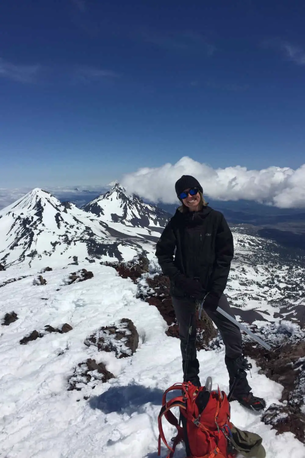
Wendy Harrington is a California native who has lived in a small town at the foothills of the Cascade Mountains in Washington state since 2001. Her love of trail running and peakbagging has led her to summit all five Washington volcanoes, climb to the high points of three states, and put nearly a thousand miles a year on her boots. Her loves include ridgelines, saddles, granite, one-day pushes on big mountains, anything volcanic, long solo days, and objectives that push limits and test endurance.
