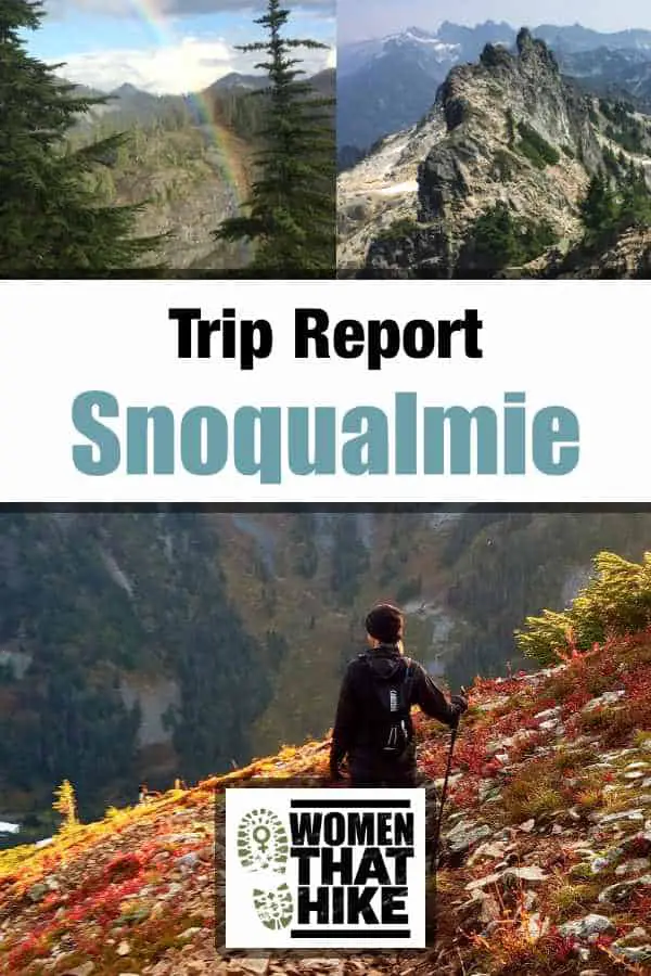
There are women that hike just to be outdoors, to be with friends, or to take beautiful photos. And women that like well-maintained trails with gentle slopes, no routefinding, and easy terrain. Or women that want an uneventful morning in nature, a good view, and then to go about the rest of their day. If you are one of these women, stop reading right now and click over to the Mount Si trip report. Mount Si is polite and well-behaved. You could introduce Mount Si to your parents and they would be taken by him and say he’s a good catch.
However, take Snoqualmie Mountain home for the holidays and your family will whisper when they think you’re out of earshot about why you always fall for the bad boys and when you’re going to settle down with someone nice.
Why Do The Good Girls Always Like The Bad Boys?
Snoqualmie Mountain has no manners, apologizes for nothing, and is never going to change, no matter how much you hope that this time will be different. It won’t. He is who is he is and you can’t fix him. He doesn’t really care about making anything easy for you; in fact, he may not actually care about you at all. But he’s tall, rugged, and oh so handsome. When you’re with him your knees go weak, your pulse quickens, and your face flushes deep red.
Afterwards you feel dirty, you shower, and you swear you’ll never do it again, yet you do: over and over you return, laying yourself at the foot of the beast with the hopes that someday he’ll lose the act or grow up or come to his senses, but he won’t. He is the highest point in the pass at 6,280 feet and has the bravado and ego to go with such a claim to fame. He isn’t going to be one of those gracious, humble peaks, like Mt. Dickerman or Hex Mountain. Nope, he’s going to make you work for it, and just a little more than you wanted to, but you’ll do it because the pros outweigh the cons (isn’t that always how we always justify becoming putty in the hands of the exception to the rule?).
The Beginning
Under all that tough guy chest-puffing is a world of beauty that’s easy to miss as all your concentration goes to just climbing up and up and up. This mountain gains 3105 feet in 1.9 miles. On paper, Mailbox Peak‘s Old Trail is a fraction of a degree steeper, but in real life, Snoqualmie’s incline feels more extreme, thanks in part to a couple of short-lived flat-ish spots mid-hike, but also due to its out-in-the-open placement in the pass. Being 1458 feet higher than Mailbox gives it a little bit of an advantage as well, if we’re having a “which one is harder?” contest. But the lush early bit of the trail (where in spring and summer you’re basically walking up a thin rocky creek surrounded by ferns) is so lovely it distracts from the large amount of elevation you’re gaining right out of the gate.
The Middle
As rocks give way to roots and mulch, you’ll notice there is less of an actual trail and more of just a path worn between trees. Eventually (it’s less than a mile in but will feel like more because of the vert) you’ll come upon what is either a raging waterfall, a small trickle, or a flat rocky area that obviously has a waterfall at times, depending on the season. Crossing this, you get your first view of the mountains across the freeway which will hopefully give you a little boost of energy when you realize you’re pretty high up.
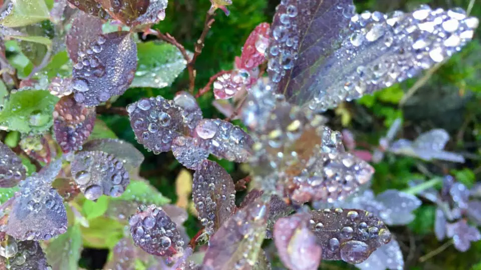
Because this part seems so unkempt and rugged at first glance, you need to make a point to notice the little details: Jesus beams shooting through the canopy to the forest floor, clouds dancing slowly revealing and hiding views of Mt. Rainier and Guye Peak, water beading up in tiny crystal balls on red leaves. Focus on the details to distract you from the work. Listen for pikas, notice the new buds in springtime, the way the color bands in the rocks change as you climb higher, the sound of the wind in the trees or the water trickling down the hills in places nearby.
A Little More Middle
Keep trudging along not even a quarter mile and you’ll pop out of the treeline and see the ridge that will take you to the top. For those of you who like breaks, this is a good spot for one. You’re about halfway, you’re out of the forest and have some amazing jagged ridgelines to gaze at, and it’s a good time to change any layers or gear (during the summer I lose long sleeves there, in the cooler fall or spring I might add a light, breathable midlayer to protect from the chilly winds that cross over the mountain there. I rarely make this climb in the winter because it has high avalanche risk from about Thanksgiving to May, but if there is some leftover snow that requires traction, this might be where you put your spikes on.
Almost The End
Your first thought when you see the ridge and the summit is going to be “You’ve got to be kidding me” because that’s what everyone thinks when they see the final push. It’s rocky, it’s large, it’s imposing, and you’ve already made your way up 1500 feet in less than a mile and are only halfway there. But back to our Bad Boy analogy, remember the first time you saw him dancing there by the record machine, eyes hidden behind aviator sunglasses, running a hand through his naturally tousled hair, biceps carved, jeans low, radiating attitude and smelling vaguely of sweat or soap and strongly of pheromones? That’s the feeling you’ll get here: you want it, you doubt you’ll get it, but you’re going to try anyway. You’ve got the legs for it, you just need to summons the confidence.
The End
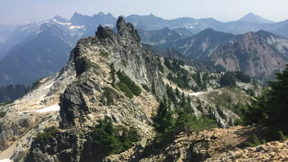
Throwing your pack on and doing a quick couple stretches, you ascend into the sky, your back to the sweeping views of the ski resort and the Kendall Katwalk area of the PCT, your focus on the rocks in front of you. You’ll notice that there is a little dirtpath weaving its way up between the boulders, not quite switchbacks or a trail, but not straight bouldering either (though if you want some scrambling practice you could certainly get some). A couple clumps of trees will provide shade and handholds and help direct you the right way, basically just don’t go too far left or right of the ridge, just stay on that spine until you see the stegosaurus-like rocks on your right and the summit straight ahead.
After an easy meandering stroll up and over and up and down for a hundred feet or so, eventually seeing the very highest point and walking over to it, the geodetic survey marker lets you know you’ve hit the jackpot. The new views out the backside give you a 360º of the surrounding Cascade Range. You’re at the highest point in Snoqualmie Pass. Have a seat on any number of nice flat rocks and bask in your accomplishment. You got his number. He likes you back.
This Magic Moment
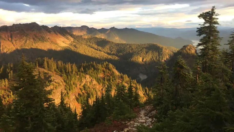
My first time up was in the fog. A thick fog that didn’t quite interfere with routefinding but definitely kept me guessing as far as what the views might be like (if there even were any), if if was going to burn off, and if this was going to be worth it visually or if it was just an exercise in, well, exercise. By the time I reached the summit, I wasn’t even a hundred percent sure it was the summit; I remember just standing there as the clouds swirled past and around me and I happened to look down and see the survey marker, and was like, ok, well, I’m here, I guess I’ll have a snack and see if it burns off.
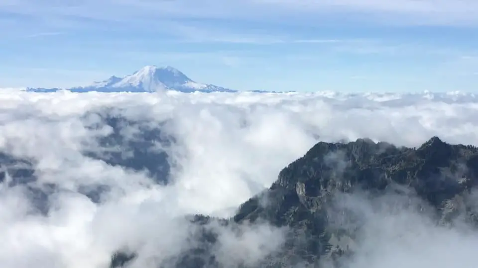
Sitting down facing south ish, a habit grown out of Rainier being our Mecca, I took out my PB&J, and within ten minutes the clouds suddenly blew away, parting like curtains to reveal blue skies and a dead-center, larger than expected Mt. Rainier with the sun hitting its flanks. I actually gasped and said something like ‘Holy Mother of Jesus” as I sat there face to face with my favorite glaciated volcano. I stood up and looked around at what I’d climbed up, what was around me, watched the clouds move around and settle into the valley below, leaving me alone on top of a peak as if adrift on an iceberg, and decided I was in love.
The Descent
The descent is not the time to relax, not on this one. They say 90% of hiking accidents occur on the way down, and this trail really makes it easy to see how and why. With no shortage of toe-catching roots, slippery rocks, rolly dirt, and unstable scree, It’s one of the few that takes me nearly as long to go down as it does up. Just please watch your step and don’t rush this part. A header would be terrible here.
Extreme Weather
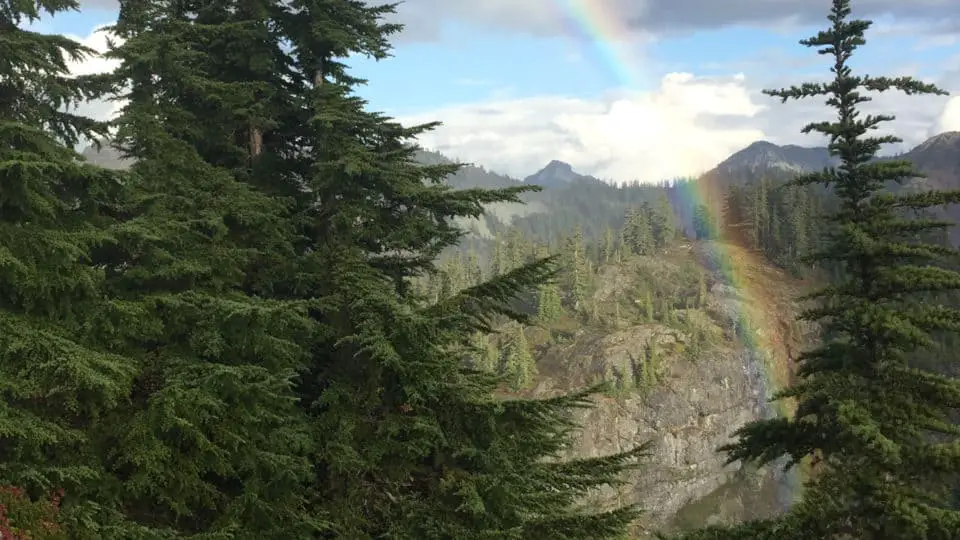
I have been on Snoqualmie Mountain when it’s pleasant in the parking lot, cloudy on the way up, and snowing on top. I’ve seen rainbows, experienced a thirty degree temp swing, and changed from shorts to pants and from pants to shorts. Even borrowed a friend’s gloves because mine got soaked through. Check the weather reports all you want but know that this is a moody one and will do whatever it wants. Bring layers, bring hand warmers, bring something for each season. It’s amazing what can happen in 3.8 miles.
How To Get There
Exiting I-90 as if you’re going skiing at Alpental, you’ll park in the parking lot on the side opposite the footbridge that goes to the ski lifts. The Snoqualmie Mountain trail is unmarked, so your landmark is the popular Snow Lakes trailhead. Fifty paces to its right, look for a subtle break in the shrubbery; that’s where your adventure begins.
[wpgmza id=”7″]
Source
Washington Trails Association: Website
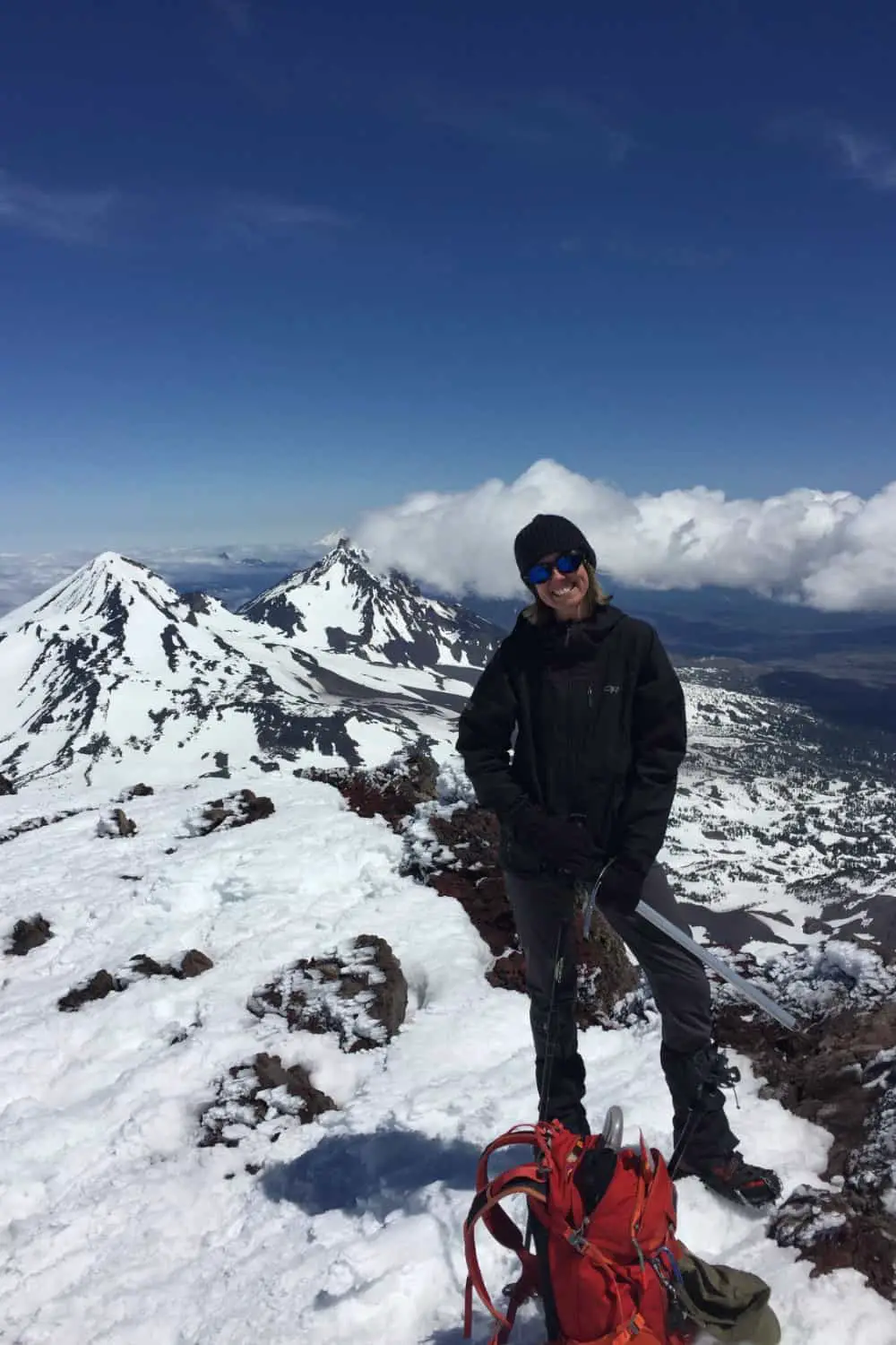
Wendy Harrington is a California native who has lived in a small town at the foothills of the Cascade Mountains in Washington state since 2001. Her love of trail running and peakbagging has led her to summit all five Washington volcanoes, climb to the high points of three states, and put nearly a thousand miles a year on her boots. Her loves include ridgelines, saddles, granite, one-day pushes on big mountains, anything volcanic, long solo days, and objectives that push limits and test endurance.