There is a reason Mount Si is one of Washington’s most popular hikes, seeing more than 100,000 people per year on its gently graded and well maintained trails. It’s a friendly mountain, giving off an air of comfort and security, as if nothing bad could ever happen there, as if its wildness is somehow tame. If it was a dog it would be the family golden retriever, not the pit bull of nearby Mailbox Peak or Snoqualmie Mountain. Especially on nice-weather weekends, the worst thing about this hike is the crowds, with their loud conversations and bluetooth speakers and terrible footwear. I’ve often tried to figure out if there’s any point on the trail where you could possibly get lost or off-track even if you tried, and I still haven’t found one, it’s like a sidewalk in that way: you can mentally check out pretty completely and still make it up and back without incident and without using your brain much … the perfect workout. If you’re a deep-in-your-thoughts hiker, Mt. Si’s main trail is your jam; there are no decisions to make or landmarks to be aware of. You’ll have cell phone reception the whole time. People call it the stairmaster because its incline is uniform to the point of monotony and makes for a great conditioning hike. There isn’t much SAR activity on Mt. Si, and if there is, it’s usually a climber on the Haystack, the Class 3+ scramble leading to its true summit which most day hikers don’t attempt. It’s easy to get lulled into its false sense of safety, and forget that you’re still in nature and anything can still happen, but I’ve seen bear scat on the trail and cougar eyes after sunset, dove so hard onto some rocks while running downhill that I have the fracture lines in my front tooth to prove it, and in a winter storm, Mt. Si can get as crazy-blustery as the best of them. At 4167 feet it’s not the tallest mountain in the area but it’s high enough to have different weather than the town below and often catches folks off-guard with its snowy top, high winds, and thick woods that go from cozily dim to pitch black the moment the sun goes down. So sure, bring the kids, bring grandma, bring your out-of-town visitors, let your guard down, but don’t forget that this suburban playground is under the reign of Mother Nature and anything can happen.
Level Up
Mount Si was my first “big” mountain. My first 8 miler. The first time I brought poles on a hike. The first time I wasn’t sure I could do the whole thing. I used to look at it from the freeway and think, no way. And then one summer’s day while going through a bunch of life turmoil and angst, I decided I needed to do something large to reset my attitude, to overwrite all the negative self-talk I was indulging in at the time, to get back in touch with my inner badass and have something I felt good about. When life is kicking you when you’re down, a decent summit does wonders to remind you that you are strong and capable, and sometimes that’s all we need. I was working late nights at the time, and I went home, took a shower, got my stuff all packed and ready, and was at the trailhead just before dawn; it was barely light enough to see, and back then I didn’t even know headlamps were a thing for regular hikers, I associated them with “those Everest people” (how I referred to mountaineers). In my mind it took all day to get to the base of the haystack; in reality it was about three hours (still slow compared to nowadays but it wasn’t all day, and anyone in reasonably ok-ish shape can do this mountain in about that timeframe). I remember sitting up there for awhile, feeling like I should soak it in because surely I’d never be there again.
Little did I know then that I’d be spending so much time on that trail that I’d have names for certain trees and certain rocks, that I’d traverse over to neighboring Little Si, Mt. Teneriffe, and Blowdown Mountain from the main/new Mt. Si trail, discover its Old Trail, or make several 16-mile days out of doing an up-and-over-and-back using both the Old and New trails, or running doubles on the New. I don’t need to check a map or an app to know how many miles in I am, and I can guess within five minutes what time I’ll hit what milepost, and there’s something comforting about knowing a trail like the back of your hand, especially when you’ve been spending time routefinding and bushwhacking out in remote areas of the state and need to relax and reset your adrenal system.
What To Expect
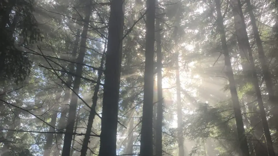
Starting out in a potholed parking lot that holds a couple hundred cars, passing by the kiosk that has a detailed map of the mountain and all its spur trails (take a photo if you have doubts about your route) and a stone foundation which doubles as a lost and found (single gloves are a big hit), you’ll cross a small bridge across a small stream, and immediately duck into the lush green forest that will envelop you for the next four miles as you make your way to the top. WTA folks have been working hard this year, putting in stone steps and tidying up the more rugged parts of the trail, and you’ll see the first of their improvements after the first switchback, and a few more before the giant log I’ve come to call Layer Log (no matter how many times I want to “be bold, start cold” I always start comfortable and peel a layer off in the same exact spot). This first quarter to half mile sees a couple teeny tiny stream crossings (literally just step over them) and at .07 mile, you can detour off to the Talus Loop trail, either connecting over to Mt. Teneriffe or joining back with Mt. Si a mile or so uptrail later. The first of the log staircases is in this stretch and makes quick work of the slightly steeper bits of the trail, though you’ll notice right away that the incline has very little fluctuation.
If you’re in a break mood, your first sit-down resting spot is in a clearing with a small bench a little over a mile in, or you can wait till two miles in, where there is a new park bench sort of bench to the right of the trail, and some wooden boardwalks that take you to what is thought to be the oldest tree on the mountain according to the plaque in front of a ginormous Douglas Fir. This is the halfway point. The next two miles are just some nice long sweeping switchbacks. At some point the handrails start, looking like something you’d tie your horse to and also serving as a nice barre for a hamstring stretch; they are on four of the switchbacks. On your right at just over three miles in is a small landing with your first real peekaboo views of the surrounding mountains and the town below and is most often where the snow starts to appear on the trail from about November to February. Of course there are times it’s higher or lower but most often this is where I find myself putting on spikes or wondering if I should, soon. Coming up on your left is the heavily-graffitied Milepost 3.5, just past that is a big rock in the middle of the trail in a part where there are some huge mossy boulders on your right; those are your in-the-homestretch indicators. Right after the Old Trail intersects the New there’s a short rocky section that empties out to the top–or rather, one of the tops.
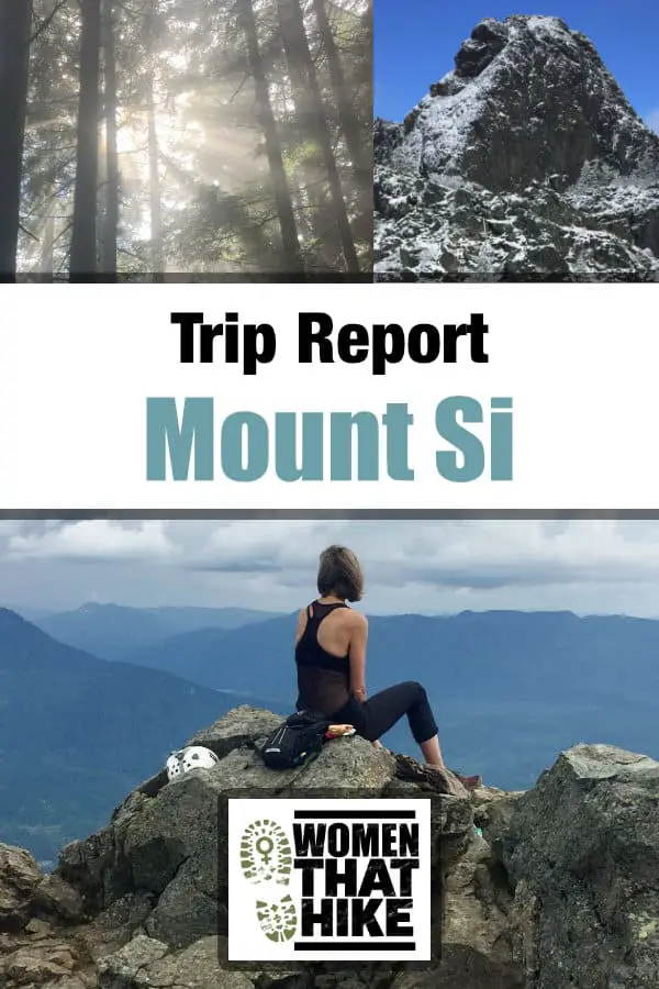
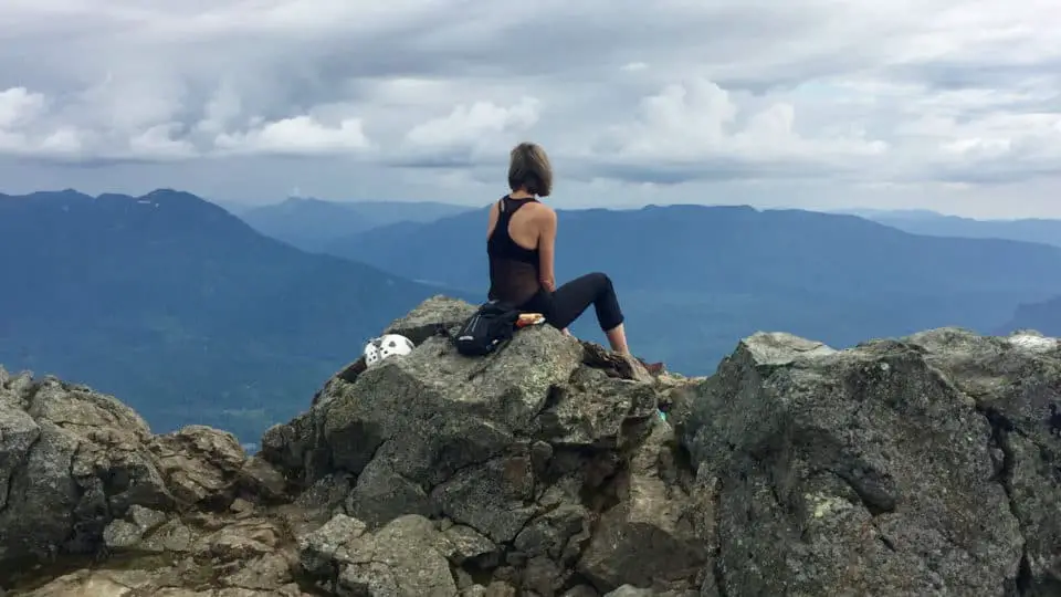
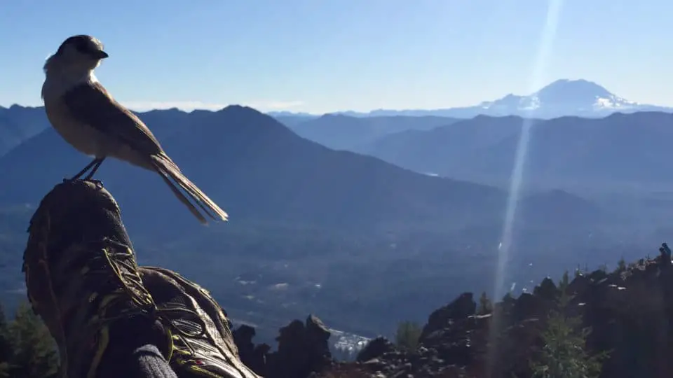
By “one of the tops” I mean there are several places to spread out and explore once the trail ends, whether you wish to picnic, scramble, or just check your time and trot back down. The summit of Mount Si is a large sprawling area with multiple rocky outcroppings populated by chipmunks and gray jays, with a wide assortment of places to chill should you wish to spend some time just enjoying the views. There’s a faint route up past the sticker-plastered sign which leads to the best seats in the house and keeps going as a footpath that forks to the right as the Mt. Teneriffe Connector and to the left to curl around the base of the Haystack.
The Haystack
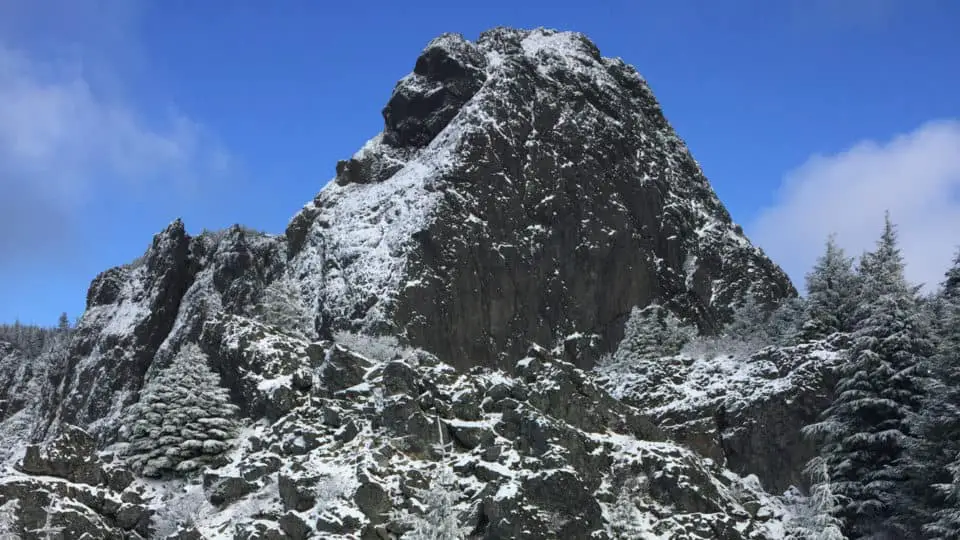
Here are a few things to know about that 150 foot nubbin that sits on top of Si and gives it that distinct profile you can see from miles away:
- It’s optional: Yes, you can absolutely say you’ve summitted Mt. Si without climbing the Haystack
- It’s a hard no when it’s been raining, snowing, hailing, sleeting, or fogging; wetness on that rock is a recipe for disaster
- If you aren’t comfortable on a Class 3+ scramble with a small section of exposure, skip it
- If you’re new to scrambling and want to get more comfortable with exposure, this is a good place to practice, but with someone who has done it before and bring your helmet and some wonderfully sticky soles
- The only deaths on Mt. Si have been falls from the Haystack and it’s the culprit for the majority of SAR activity on the mountain (either falls or getting cliffed out)
- Never scramble up something you don’t think you can get back down
The first time I attempted the Haystack was very early in my hiking career when I was still only using my hind legs to get places. I got partway up and froze, plastered to the wall like a little starfish, hyperventilating and not sure how to go up or down. Embarrassed, I didn’t try again for several months, this time with someone, but not someone who had been there before. We got a good ways up the gully before realizing that the only way to the top looked so exposed we thought there was no way it could be right, so we downclimbed back to the base and stared at it for awhile. Third time being the charm, I went with a friend who had been up numerous times and clambered up it like a goat, having had practice with compartmentalizing the fear and vertigo, not looking down, trusting my body and the holds, and having spent months in a climbing gym, developing upper body muscle, skill, and confidence. When we reached the top and I looked around and said, “Is that it?” we had a good laugh about how words like easy and difficult and impossible and fun and dangerous and doable are all relative and change over time based on experiences and skill, and how all we need to do is keep pushing at the edges of our comfort zones until they are so wide that all our dreams fit inside them.
If you’re an experienced climber, you’re probably chuckling at all the fuss over something so amateur, but I’m talking to the Everyhiker here, the ones in the jeans holding the bottle of Crystal Geyser, and not even the largest size. The guys who have been pounding beers down at the Pour House all morning then decide it’s time to hike. The yoga pants girls who just want the Insta shot, the same ones who fall off the edge of the Grand Canyon, likely due to the weight of their false eyelashes.
It’s All Yours
The truth is, this trail is like a blank slate and will wind up having its own meaning and purpose and challenges for each person using it. It can seem impossibly difficult for the novice (when I hear someone describe it as “really steep” or “super rocky” I know they are new) or easy breezy cover girl for the accomplished mountain climber. It can feel long to little kids and short to ultra runners. Training and need a challenge? Do a double in the snow with a weighted pack. Or is this a first-date hike where you’re a ibit concerned about being abducted? Si on a Saturday. If you’re starting out doing solo hikes, Si is your guy (even in terrible weather I have never been alone there). The fact that it is so even and so predictable makes it a great hike to measure your progress while training; there was a time I was doing it twice a week, one with weight and one just for speed, and seeing the minutes get shaved off with every trip really kept me motivated and allowed me to see my improvements.
And then some days it’s just a quiet walk in the mossy foggy woods with no view whatsoever from the top. Those might be my favorites, when everything feels primeval and intimate, when there’s enough rain to keep the tourists away but not so much that I’m drenched, when it’s just me and it, and the head gets real quiet, the legs do the work, and the soul can relax into the nourishing mulch and cradling boughs that surround as far as the eye can see.
Can You Hike Mount Si In Winter?
Yes! Can, and should. Sitting at just 4167 feet, Mt. Si in the winter is often among the last peaks to get snow, so if you’re looking to avoid the white stuff, Si will be more up your alley than its neighbors to the east like Mailbox. But if you enjoy hiking in the snow, Si is a good choice due to its easy road access and practically nonexistent avalanche danger.
If you’ve never worn spikes, this is a great trail to practice on. If you aren’t great at navigation you’ll be ok; the trail never gets buried to the point you can’t tell where it goes, and it usually has an obvious footpath as well as other hikers. And if you want to try out snowshoes, the connector trail on the saddle between Si and next-door Mount Teneriffe is often thickly blanketed and not frequently traveled. I’ve been up to my thigh in snow there when other areas just had a dusting. But for most of the winter, there’s only snow on the upper half and on the trail it gets pretty packed down and dirty, sometimes icing over but usually slushy, changing as temps fluctuate.
As far as gear goes, and we get into this more in <this article> with a full gear list, you definitely want to think of winter Si as a completely different beast, and pack accordingly. During the summer and even most of the shoulder seasons you can get away with having nothing but water and maybe one extra top layer, but winter can give off a strong mountaineering vibe in terms of gear, clothing, safety, and overall preparedness.
For conditions during the winter, because they change so often, check WTA for trip reports, or mountain-forecast for specific weather at specific altitudes. A good rule of thumb is that (if there’s no snow or rain falling and you aren’t in thick fog) the temperature drops about 5ºF per thousand feet of elevation. So with its 3150′ of gain, the top of Mount Si will be about 15º cooler than the parking lot. While in summer a drop from 80º to 65º isn’t that big of a deal and can actually feel pleasant, going from 45º to 30º can be a rude awakening for the unprepared.
But bottom line, Mount Si is beautiful and easily doable year-round, including those dark winter months when it rests under a thick blanket of sparkly white.
Mount Si Twin Peaks Tie-In
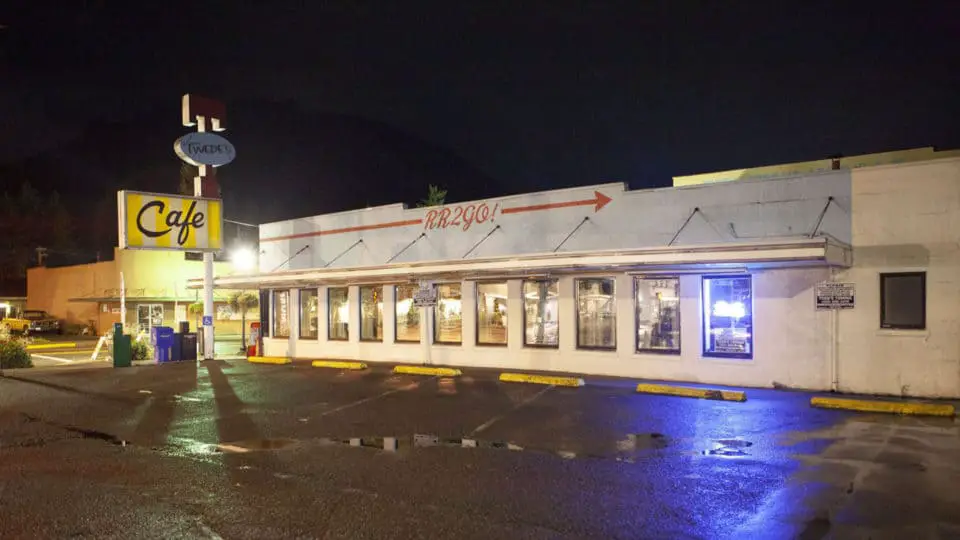
Fans will recognize Mount Si as the backdrop for the fictional town of Twin Peaks in the show of the same name. The Double R Diner, after several name changes, fire, remodel, and restoration, remains on the corner of North Bend and Bendigo Boulevard as Twede’s Cafe, continuing to serve its famous cherry pie and that damn fine cup o’ coffee Agent Dale Cooper made famous.
Native Folklore
According to ancient Snoqualmie tribe legend, Mt. Si is the body of Snoqualm, the moon, who fell to his death from the sky to the earth, into the earth, leaving half his circular shape jutting up out of the floor of the valley. The story has taken on a variety of details and embellishments but the main story is that Snoqualm had ordered that a rope of cedar bark be stretched between the earth and the sky, but then Fox and Blue Jay went up the rope and stole the sun from the moon, who then chased them down the cedar rope, but it broke and he came plummeting down. Fox then let the sun free in the sky and gave fire to the people, and a face like Snoqualm’s is visible on the rocks near the summit. Obviously not factual but I have to say that when the moonlight hits Si, it hits a little differently than it does on other mountains.
How To Get There
The easiest and most obvious way to get there is just to get off I-90 at exit 32, go left across the freeway, then left onto North Bend Way and a quick right onto Mt. Si Road. However, as most adventurers know, easy and obvious doesn’t always make for a memorable experience, so take exit 31 (Bendigo Blvd) instead and go left at the offramp then right onto North Bend Way and take the main drag through town, scanning the cute shops and pubs and diners for your post-hike grub: I personally recommend Scott’s Dairy Freeze, but Los Cabos, the North Bend Grill, and of course Twede’s all provide that reward slash calorie replenishment slash place to airdrop photos. After eight miles and 3150 feet of gain, you will have worked up an appetite worthy of one of Scott’s amazing flavored shakes (I recommend huckleberry or peanut butter) and a nice big cheeseburger hot off the grill. Delightfully greasy fries optional.
[wpgmza id=”3″]
Source
Washington State Department of Natural Resources: Government Website
Wendy Harrington is a California native who has lived in a small town at the foothills of the Cascade Mountains in Washington state since 2001. Her love of trail running and peakbagging has led her to summit all five Washington volcanoes, climb to the high points of three states, and put nearly a thousand miles a year on her boots. Her loves include ridgelines, saddles, granite, one-day pushes on big mountains, anything volcanic, long solo days, and objectives that push limits and test endurance.