Tiger Mountain is home to an extensive trail system, and The Chirico Trail to Poo Poo Point is hands down its most popular spot. In fact, it’s one of the more well-known hikes in the greater Puget Sound area, as it’s just a half hour from Seattle, is accessible by any vehicle, can be done year round, and has a great effort-to-payoff ratio, with sweeping views of the region after less than two miles of easy hiking. There are two ways to get there, so if you’re looking for the same view with a little more mileage, Poo Poo Trail goes up the backside of the same hill in twice the distance. But read on for everything you’ve always wanted to know about the Chirico Trail, plus some random facts to amuse your friends with as you make your way to the top!
The Chirico Trail
I can’t say this was literally my first hike, like many Washington folks can, but when I moved to Seattle from Los Angeles, I was taken here as a PNW rite of passage along with places like Pike Place Market, the Space Needle, and the Fremont Troll. Later when I moved out to the suburbs to a little house in the shadow of Tiger Mountain, I began hitting the trails on the regular, and the Chirico route up to Poo Poo Point became the first trail that I started to feel a real connection to, the first one I started to memorize landmarks of, the first one I timed myself on, ran doubles on, the first one I went to alone and not part of a social or kid outing. So in many ways I think of it as my first hike and it will always hold a special place in my little mountain heart.
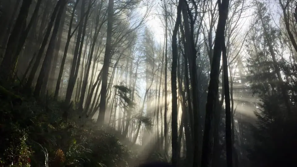
Just a mile or so out of downtown Issaquah, you’ll find a field and a parking lot, a couple of picnic tables, and the multicolored ballooning chutes of paragliders landing. This is where your hike on the Chirico Trail begins. Cross the field to the trailhead, which is clearly and artistically signed with an arch, a couple of benches, some flags, a wooden carving of a winged bear, and some beautiful metalwork featuring a crest and the words Chirico Trail. Crossing a small wooden bridge and walking a hundred yards or so will land you at what used to be the old trailhead before the slight reroute that steered hikers out of the way of the paragliders’ landing strip. Duck into the shade of the lush mossy woods, surrounding yourself with ancient Douglas firs, moss-covered logs and rocks, and an amazing amount of ferns. The green is so vivid it looks like an edited photograph with the saturation cranked all the way up.
The trail here is uneven and rocky, but safe as long as you pay attention. Recent rain adds slickness to the rocks, and fall leaves hide little obstacles underfoot, so watch your step — and there’s no shame in bringing poles on what some consider an easy hike if you’re new to trails or just not very confident in your footwork. Less than a quarter mile in, the rocky trail turns into what is basically a stone staircase comprised of wide flat slabs taking you up a few hundred feet in elevation, where after a switchback, the trail returns to more of a dirt-gravel-rock mix.
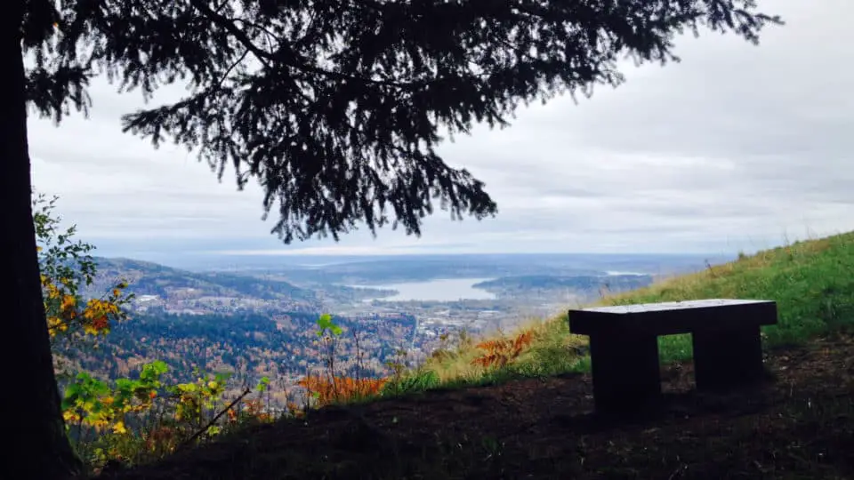
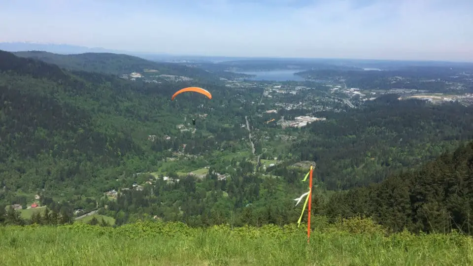
The Chirico Trail is not short on benches and rest stops; the first bench is about a mile in and many folks use it for a quick shoe-tie, snack, or rest for the kids or dogs. Pushing on ahead, the forest gets airier and more open, continuing to exude that impossibly vibrant green. A couple of nice flat stretches break up the second mile, then a gradual final push to the first viewpoint, which is a large field home to dogs and frisbees, senior pictures, picnics, school trips, the occasional yoga class, and another bench. Rainier is front and center as the foothills roll away to the south, and if the wind patterns allow paragliders to launch from this side, it’s worth staying to watch and capture some action photos.
The Scene At The Top
The Chirico keeps going across that field before ducking into the woods for a final (and often a bit muddy) few minutes of hiking, at which time you pop out of the woods to the main launchpad, yet one more bench, and a picnic table, which is the highest point of the Chirico Trail. The panoramic view stretches from Lake Sammamish to Bellevue to downtown Seattle and the Sound. On a weekend day you could easily pass over a hundred other folks on the trail, and both viewpoints often host dozens of people relaxing in the grass, talking, stretching, picnicking, napping. Whether you are a runner looking to train on hills, a newish hiker not ready for big mountains, a seasoned hiker short on time but in need of vert, or a family with small children just wanting to see some birds and plants: if you like forests and views and don’t mind crowds, the Chirico might become part of your routine the way it has for so many northwesterners.
This trail is also home to several events, one of which is the annual Chirico Tenpeat, where the goal is ten laps in twelve hours, and barring that, just do as many as you want, or can. It’s free, you don’t have to register, and there are no real prizes given (other than the furry tiger hat that gets passed on to the winner from the previous year’s winner). I did it a couple years ago while I was going through a rough patch emotionally and decided that I needed something mentally and physically brutal to help push me through it, and boy did it do the trick. At 7 am we all sprinted out of the gate and fell into place, spreading out into a single file of a hundred or so hikers. By my fourth lap I was so far deep in the zone I was losing chunks of time. People were starting to lap each other and everyone looked familiar and I felt like Bill Murray in Groundhog Day. I wound up only doing eight laps; it was 6pm and my pace had slowed, making a one hour round trip impossible. So I lounged around barefoot in the grass and watched people finish, doing the math in my head: 11 hours, 30 miles, just over 14,000 feet gained and lost over and over and over. I played with a blister and knew my left second toenail would turn black and come off, and felt like I became a part of the mountain that day.
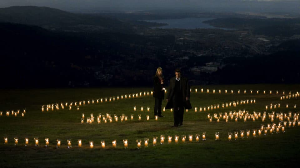
I’ve also been there when there’s a day camp of five year olds wandering all over the place, a senior group out for a day of companionship and fresh air, or teenagers in Halloween costumes. I’ve watched my dad paraglide off the north launchpad, witnessed a proposal, and taken both of my kids at all ages of their lives. I’ve been at night, on sweltering hot days, and knee deep in snow. I’ve trained with a heavy pack and broken in new boots there. It’s like having your own hill, like a second home.
How Long Of A Hike Is Poo Poo Point?
From the parking lot to the top via the Chirico Trail , it’s 1.9 miles with an elevation gain of 1760 feet. An average hiker will need roughly two to three hours to complete this hike, but that is just a loose estimate and varies wildly. I know some amazing runners who can make it to the top in a half hour, and my fastest time running down it is 22 minutes, but I’ve also taken the better part of a day to do it with a toddler and a picnic and a wide open schedule. If you’re a typical one-hour-per-thousand-feet type, you’ll hit the top in under an hour and a half, but if you know you are slower or faster than that, adjust accordingly.
Fun fact: The Chirico Trail is only one way to get to Poo Poo Point. If you’re looking for a couple more miles that end with the same amazing view and the entertainment of watching the gliders launch, check out the Poo Poo Trail, which starts off of the High School Trail just a short drive away. That trail meanders lazily up the backside of West Tiger Mountain, gaining the same 1760 feet but taking almost exactly twice the mileage to get there. See this article for details.
If you’re up for a challenge or training for bigger mountains, you can link both trails together: go up one and down the other, then up and back down to where you started for close to 12 miles with just over 3500 feet of gain.
Poo Poo Point Gray’s Anatomy Tie-In
Trivia for you Gray’s Anatomy fans: Derek’s house is on Poo Poo Point. Not in real life. There’s nothing up there in real life except a bench. But in the show, by some sort of green screen CGI miracle, Dr. Shepherd builds his dream home on state forest land, and, even more exciting, takes the ferry to work on Lower Queen Anne Hill (I guess the writers didn’t think anyone from Seattle would watch the show).
Why Is It Called Poo Poo Point?
If you’ve wondered where this normal spot got such a strange name, look no further than the traintracks that run diagonally across the town of Issaquah. You can see them clearly from Poo Poo Point, and the old story is that back in the day (early 1900s), hikers could hear the trains that used to run through the area from up there, and of course we all know trains make a “poo poo” sound, right? No. It’s “choo choo.” Have you ever heard anyone refer to a “poo poo train?” Me either. So I personally don’t buy it and really enjoy making immature jokes about it like the rest of the twelve year olds in town, but that is the alleged origin of the name.
Why Is That One Spot Devoid Of Trees?
In the 1970s, then-owners the Weyerhauser Corporation logged that area taking all the trees and their stumps and roots, leaving a bald spot that can be seen for miles around. This large clear are turned out to be a perfect place from which paragliders could launch, as it is flat at the top and cliff-like to the north, creating a perfect arena for a running start and graceful jump off. Most independent paragliders backpack their gear to this launching pad, but there is a road that goes to it as well, used by the local paragliding company for its clients.
How To Get There
if you haven’t been up it yet, do: it’s a staple item and best on weekday mornings when the crowds are less, even better on slightly bad weather days. If you’re ever in the Puget Sound area, come on out and be one of the millions of footprints on this old faithful Washington hike. Super easy to get to, just exit i-90 at Front Street and make a right, driving through Old Town Issaquah about three miles or until you see the shadows of paragliders circling lazily in the sky, and then make a left into the parking lot.
[wpgmza id=”5″]
Source
Washington State Department of Natural Resources: Government Website
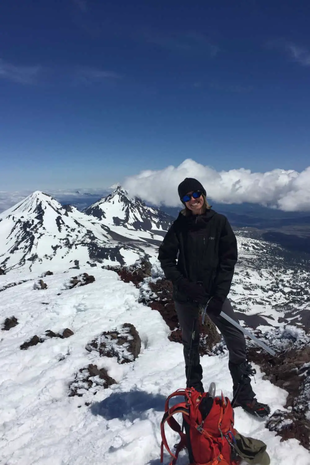
Wendy Harrington is a California native who has lived in a small town at the foothills of the Cascade Mountains in Washington state since 2001. Her love of trail running and peakbagging has led her to summit all five Washington volcanoes, climb to the high points of three states, and put nearly a thousand miles a year on her boots. Her loves include ridgelines, saddles, granite, one-day pushes on big mountains, anything volcanic, long solo days, and objectives that push limits and test endurance.
